Nullam dignissim, ante scelerisque the is euismod fermentum odio sem semper the is erat, a feugiat leo urna eget eros. Duis Aenean a imperdiet risus.
Nullam dignissim, ante scelerisque the is euismod fermentum odio sem semper the is erat, a feugiat leo urna eget eros. Duis Aenean a imperdiet risus.
 24 x 7 Helpline: 1800 425 4409
 tnforest@nic.in
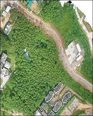
Drone Mapping of notified areas like Wetlands, Ramsar sites, Conservation reserves
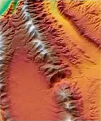
DEM & LIDAR data for planning Soil – Moisture Conservation works, assessment of area below tree canopies
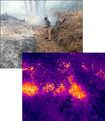
The fire/heat hotspots are identified using the Thermal Drones during the fire suppression